San Jose


San José, San José, Costa Rica

Suggest Place to Visit
2779
Track to location with GPS |
 |
BRIEF HISTORICAL REVIEW
The territory that today corresponds to the canton of San José, was inhabited by indigenous people from the so-called Huetar de Occidente Kingdom, which at the beginning of the colonization were the dominions of the Garabito chief.
The valley in which the capital city sits began to be populated by Spanish colonizers at the end of the 16th century. One of the first places mentioned in the land authorization is Mata Redonda; that began to have importance as a result of the division made by the governor of the province of Costa Rica, Don Diego de Artieda Chirrino (1574-1590); by granting it to Don Pedro de las Alas, who formed a herd of cattle there. On the death of Don Pedro, the Mata Redonda herd was divided between his two sons; Captain Juan de las Alas was assigned the Mata Redonda and Second Lieutenant Pedro de las Alas was assigned the western sector, called Las Pavas. The name of Mata Redonda, which had begun to be mentioned in a power of the inhabitants of that site in 1607, is later cited in the protocols of Carthage in October 1623, on the occasion of a power that Captain Don Juan de las Alas, the Ensign Mr. Luis Machado and Messrs. Salvador Torres, Francisco de Cháves, Andrés Jainus, Francisco Rodríguez de Sosa and Andrés Murillo, on behalf of the residents of Barva and Mata Redonda, awarded Mr. Francisco Castro and Mr. Juan Martínez Ferrera, attorneys of the Audience of Guatemala. The previous document shows that already in that year there were a number of residents on the site.
In 1630 Captain Don Juan de las Alas declared that he was the owner of a ranch in the place called Mata Redonda, where two houses with thatched roofs had been built, and had two hundred cattle and forty tame horses and mares. Two years later Don Salvador de Torres, commissioner, in his will indicated that he had a place in Mata Redonda. By 1640, the Spanish María de Aguilar, whose name preserves one of the rivers of the present canton, also appeared as the owner of properties that adjoin the Mata Redonda herd.
In the last years of the seventeenth century, the Spanish population scattered in the Aserrí valley or Currivará valley, had increased in such a way that the Cofradía de la Pura y Limpia Concepción de
María Santísima established in Cartago, in 1577, considered it necessary to appoint special deputies for the care of the confreres residing in it, a position that was successively occupied from 1681 to 1696 by Messrs. Juan de Valbuena, Juan de Espinoza, Alonso Berrocal and Juan de Castro.
Given the growing increase in the population, the Bishop of Nicaragua and Costa Rica, Monsignor Don Fray Benito Garret y Arloví, ordered in his pastoral letter of May 10, 1711 that oratories or hermitages be built where mass could be heard and received the holy sacraments; In compliance with the above, the priest Don José de Cháves erected an oratory on his farm that he had in the plain of the Torres river, to which the residents of the place came.
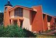
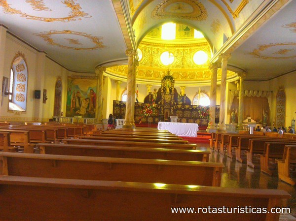
In the year 1736 the town hall of León decreed the establishment of a Church in the Aserrí valley, dedicated to Mr. San José; the site that was chosen was Boca del Monte. The priest of Cartago, priest Don José Antonio Díaz de Herrera, was ordered to move to the valley and with the help of the neighbors, to build the church; which was completed the following year, on the site that today corresponds to the place located half a block between the central and first avenues, in front of the east side of the Central Bank of Costa Rica. On May 21, 1737, the priest Don Hermenegildo de Alvarado y Girón was appointed, Coadjutor of the Help of the Parish of San José de la Boca del Monte in the Aserrí valley. A year later it was blessed by the priest Don Manuel Casasola y Córdoba. Subsequently, some residents of the incipient little village, given the poor conditions in which the hermitage was located, built a new adobe parish church, which they concluded in 1776, in the place where the cathedral church is today. It was badly affected by the 1781 earthquake. The parish church was built into a cathedral in 1850, when the diocese of San José was established. It is currently the seat of the Archdiocese of San José, of the ecclesiastical province of Costa Rica.
The inhabitants of the Aserrí valley were initially reluctant to build their dwelling houses near the hermitage, partly because they did not want to abandon their herds and because there was no water facility near the church. In February 1750, the priest Don Juan de Pomar y Burgos, left the position of priest in the parish of Nuestra Señora de la Asunción de Cubujuquí (today Heredia) and moved to the little town of Boca del Monte to start the conduction work from the water to the site, managing in August of that year to establish a ditch that would take the water to the north side of the hermitage. This modest aqueduct or water outlet gave a boost to the town and ensured its existence, since immediately the inhabitants of the valley began to build their homes on the site. The following year, the place had a church, an aqueduct, fifteen houses with thatched roof and eleven with a tile roof. At the beginning of the 19th century, San José received water from the Torres River, through a canal that entered from the east of the city, later being distributed in smaller courses through other neighborhoods. In 1868 the San José pipeline was formally inaugurated.
The city of San José was favored with the cultivation and commercialization of tobacco, since the surrounding lands were more suitable for its exploitation, mainly those located to the north of the city; where the tobacco plantations that were exported to the Kingdom of Guatemala and other places were established. At the end of the 18th century, the Tobacco Factory was built, located in the space that today occupies the Central Bank of Costa Rica, originating in a short time a great activity around it.
The deputy of the province of Costa Rica before the Cortes of Cádiz, in Spain, the priest Don Florencio del Castillo, managed to get them to grant, on October 16, 1813, the title of city to the town of Villanueva de San José. On May 16, 1823, in the Political Statute of the Province of Costa Rica, it was ordered that the capital be, as of that date, the city of San José.
The San José city council that was established based on the Constitution of Cádiz, on May 19, 1812, began to function in January 1814, which was integrated with the following people: Gregorio Ulloa, Manuel Hidalgo, Cipriano Fernández, José Ana Jiménez , Miguel Carranza, Félix Fernández, Félix Martínez, Juan Esquivel, José Castro, Anselmo Aguilar and priest Manuel Alvarado. The secretary was Don Tomás de Alvarado.
In the aforementioned Constitution of 1812, it was arranged to request all the provinces of the Spanish kingdom to establish schools where there were a number similar to a thousand souls. In such a way the city of San José
GEOGRAPHICAL POSITION
The mean geographic coordinates of the canton of San José are given by 09 ° 56´ 16´´ north latitude and 84 ° 06´ 55´´ west longitude. The maximum width is 16 kilometers, in the northwest to southeast direction, from the Electriona power plant, to the bridge over the Tiribí River, regional highway No. 211, which runs from San Francisco de Dos Ríos to San Antonio de Desamparados.
PHYSICAL ASPECTS
geology
The canton of San José is geologically constituted by materials from the Tertiary and Quaternary periods, being the volcanic rocks of the Quaternary those that predominate in the region.
From the Tertiary period there are rocks of sedimentary origin from the Miocene epoch; that correspond to undifferentiated material, located in a small sector of the canton, in the Nice neighborhood.
Among the materials of the Quaternary period are rocks of volcanic and sedimentary origin from the Holocene epoch. The first correspond to volcanic materials, such as lava, tuff and pyroclasts, located in the largest area of the canton, which are located to the west of it, from the sector between the Escalante and Hatillo Cuatro neighborhoods. The sedimentary rocks belong to fluvial and colluvial deposits, located in the southeast of the region.
Geomorphology
The canton of San José is part of the geomorphic unit of volcanic origin, represented by the volcanic filling of the central valley, which corresponds to a flat wavy surface. It is possible that the changes in relief within the area are due to the presence of lava a few meters deep, constituting a front.
The unit is formed on the surface by volcanic rocks, mainly lavas, tuffs and ignimbrites covered by ash in a variable thickness. The sequence of lavas rests on sedimentary rock. The lavas are of the andesitic type.
Geomorphologically, this unit is not a valley, however for political, socio-economic and all kinds of reference, it is considered preferable to continue calling it the Central Valley. The correct technical name is rift valley, due to the presence of a fault along the entire foot of the Central volcanic mountain range, which is evidenced by the existence of thermomineral sources, as well as the abrupt interruption aligned with the supposed fault of the foothills that descend from the aforementioned sierra to the valley, as well as the presence of volcanism without apparent explanation (Pacacua Formation), in correspondence with the position of the fault or near it.
Altitudes
The elevations, in meters above mean sea level, in some parts of the district head of the canton, are the following:
Carmen 1,179, Merced 1,146, Hospital 1,150, Cathedral 1,161, Zapote 1,175, San Francisco de Dos Ríos 1,165, Uruca 1,110, Morenos 1,133, Pavas 1,045, Hatillo 1,123 and San Sebastián 1,131.
Hydrography
The river system of the canton of San José corresponds to the Pacific slope; which belongs to the Rio Grande de Tárcoles basin.
The rivers that drain the canton are Torres and María Aguilar, with its tributary Ocloro; which join the Tiribí river and east to the Virilla river; as well as the Rivera stream, which is a tributary of the latter. These rivers run from east to west. The Virilla, Tiribí, Torres and Ocloro rivers, as well as the Rivera creek are cantonal limits; the first with Heredia and Belén in the province of Heredia; the Tiribí, with those of Escazú, Desamparados and Alajuelita; the Ocloro with Montes de Oca, the Torres with Goicoechea and Tibás, and the Rivera stream with the latter.
REFERENCE TO BASIC MAP OF COSTA RICA
Basic map sheets 1:50 000 (IGN): Open.
Map sheets 1:10 000 (IGN): Cubujuquí, Curridabat, Escazú, María Aguilar, Pavas, Real de Pereira, San Antonio, Torres.
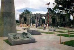
The idea of preserving and displaying the relics and historical records of a culture are some of the tasks of museums in the world.
Perhaps the activity with the most social projection is the educational and formative role of the museum, hence the worldwide importance of this type of institution. That more than an exhibition window should be part of the didactic process of citizen training.
Costa Rica has a large collection of relics as proof of the cultural richness of our people and which in turn are the basis for the development process of our country, both in archaeological research and in artistic and technological creation; as well as the preservation and restoration of our Natural Heritage.
Comments
We don´t have yet any comments about:
San Jose
San Jose
Be the first to leave a comment as it is very important to inform other people
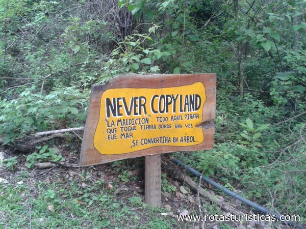
Outros locais a visitar
Within a radius of 20 km from:San Jose
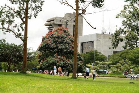
La Sabana: the Costa Rican Park |
| 0,0 Km |
 |
Santo Domingo |
| 5,3 Km |
 |
Pacuare |
| 5,9 Km |
 |
Escazú |
| 6,3 Km |
 |
Heredia |
| 7,7 Km |
 |
Fossil Land |
| 8,7 Km |
 |
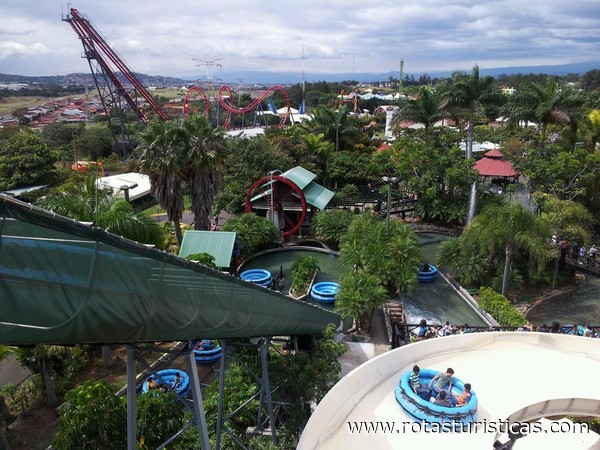
Water Land |
| 10,4 Km |
 |
Barva |
| 10,7 Km |
 |
Club Campestre Español |
| 13,0 Km |
 |
COLYPRO |
| 13,9 Km |
 |
Santa Barbara |
| 14,2 Km |
 |
Catedral de Alajuela |
| 16,9 Km |
 |
Museo Histórico Cultural Juan Santamaría |
| 17,1 Km |
 |
Souvenir Museum Verdes y Colores |
| 18,0 Km |
 |
Cartago |
| 19,7 Km |
 |
Hotel reservation near San Jose within a radius of 20 km

Why to book with ROTAS TURISTICAS
The best prices
Our partnerships with the world´s largest operators offer research on the best market prices.
More options
At Rotas Turisticos you can book the hotel, buy the air ticket, book the transfer from the airport to the hotel and vice versa, book the local excursions, rent the car, take travel insurance and consult the places to visit and where to go.
Holiday Tips & Destinations
Hundreds of holiday destinations with all the options that allow you to easily choose the destination that best suits your dream vacation.
ROTAS TURISTICAS
Links
Follow us on social networks


