Yarumal


Yarumal, Antioquia, Colombia
Suggest Place to Visit
687
Track to location with GPS |
 |
Yarumal was founded by the Visitor and Governor of Antioquia Juan Antonio Mon y Velarde with the name of San Luis de Góngora on March 29, 1787. It seems that this name came from the imagination of the aforementioned governor, as it is not known of the existence of such a saint in the catholic saints.
The act of its foundation reads: ´´In the Morro Azul mountain, of Our Lady of Candelaria, on March 29, 1787, I, Don Pedro Rodríguez de Zea, lieutenant of the governor and administrator of the Royal Treasury of these valleys of bears and new populations, having arrived here on December 28 of the current and found many inhabitants, and missing others; some because of the proximity of Easter and others through the voices that circulated; I had trails to be opened to find the largest place and found the town ... I read out loud twice the decree of Mr. Oidor in the presence of Mr. Plácido Misas´´.
Its first mayor was Don Francisco Leonín Estrada, who built his first thatched roof temple, which would later evolve into a brick and tile construction. Today, the temple of Nuestra Señora de las Mercedes occupies that same place.
Municipality was erected in 1821.
Yarumal played an important role in the liberating feat. In its dominions the famous combat of Chorros Blancos was fought, an action that consolidated the victories of Bolívar's army in battles such as El Pantano de Vargas and Boyacá, the latter on August 7 of the previous year.
Currently, it is a municipality of great commercial development. Several attractions have to do with the most illustrious of his sons, Epifanio Mejía, author of the Antioqueño Hymn. Cultural tourism is one of the current attractions, with places like the Monsignor Juan N. Rudea Museum and the House of Culture.
Yarumal is a municipality of Colombia, located in the northern subregion of the department of Antioquia. It limits to the north with the municipality of Valdivia, to the east with the municipalities of Campamento and Angostura, to the northwest with the municipality of Briceño, to the west with the municipality of San Andrés de Cuerquia and to the south with the municipality of Santa Rosa de Osos. Its municipal seat is 123 kilometers from Medellín.
Its municipal head is made up of 20 neighborhoods and the rural area of 52 sidewalks and 7 townships. Its climate is very cold due to its elevation above sea level (2,265 m). The current name, Yarumal, comes from the plant species called yarumo, from the Moráceas family, very abundant in the region in the days of the foundation and known in the Latin botanical language as Cecropia peltata L. The municipality is also called the Altarpiece City, the North Star and the North Sultana.
Yarumal is located north of the department of Antioquia, 123 km from the city of Medellín. The entire territory presents a fairly mountainous relief, as it is located on the foothills of the western branch of the central mountain range of the Andes. The municipality has a territorial extension of 724 km², of which 2.1 km² correspond to the urban area.
Weather
The municipal head (the main urban area of the municipality) is located on a low montane very humid forest formation, in which an annual average rainfall of between 2,000 and 4,000 mm occurs and provides an average temperature of 17 degrees Celsius, varying in a range between 12 ° and 19 °. On the other hand, towards the east of the population, through the area of the municipality of Campamento, the forest formation becomes very humid premontane, with the same precipitation but with a temperature that runs between 18 ° and 24 ° Celsius. The rainiest season in Yarumal is August and the least is February. The territorial extension of Yarumal (724 km²), is distributed in thermal floors as follows: 16 km² in warm climate, 275 in medium climate and 433 in cold climate. There is no paramo-type thermal floor.
Hydrography
The municipality has a large number of rivers, broken swamps, etc., thus having good water potential. The main tributary of the Yarumal territory is the Nechí River, which has its source in the Llanos de Cuivá and is called the Yarumal River. Later it takes the name of Cañaveral (in the territory of Campamento) and in the lower part it is properly called Nechí, and then spills its waters into the Cauca River. The Nechí was important in the eighteenth and nineteenth centuries, as it was a way of penetration, through diversions of boats that passed through the Cauca River. Its waters were among the richest in gold of all that existed in the region.
Also noteworthy are the streams Pajarito (near Guásimo), Picadores (the one that previously supplied the old aqueduct), Santa Juana, (the one that supplies the current aqueduct), Yarumalito (with its gold mine tunnels full of legends) , Santa Rita (in the path of the same name near Mallarino), Espíritu Santo, el Rosario or Media Luna (born in Alto de la Hundida), Ochalí and San Antonio, and the San Julián and San José rivers.
Demography
According to DANE figures for the 2005 census, Yarumal has 41,240 inhabitants, of which 26,603 (64.50%) live in urban areas and some 14,637 (35.50%) reside in rural areas. The municipality has a population density of approximately 56.26 inhabitants per square kilometer. Of the total population, 46.8% of its inhabitants are men and 53.2% are women. Yarumal's population growth has been influenced by a series of factors such as; displacements due to violence, increases in Andean crops, geostrategic location, labor interests, among others. This growth has made the municipality one of the most populated in the region, a dynamic that is reflected in the imbalance between the rapid population increase and the slow urban development.
The literacy rate in the population over 5 years of age is 88.1%. Public services have high coverage, since 96.7% of the dwellings have electric power service, 84.4% have aqueduct service and 76.2% have telephone communication.
Administrative divition
The urban area of Yarumal is made up of 27 neighborhoods, and the rural area is made up of 52 villages and 7 townships. The delimitation of the urban area is approved by the Municipal Council by means of agreement No. 44 of August 30, 1995, by means of which "the territorial delimitation of the urban and suburban perimeter in the municipality is established."
The economic activity of the municipality derives from livestock, agriculture, mining, commerce and industry:
Among agriculture there are crops of Coffee, Sugar Cane, Beans, Banana, cassava, Corn, potatoes, Cacao.
Among the livestock that is exploited are cattle and pigs.
Among the mining there is gold, talc and limestone stone, marble;
Among the Industry are Setas de Colombia, Tablemac, Talcos de Yarumal.
As for the yarumal trade, it is very active, as it is a strategic center between the Atlantic coast and the interior of Colombia.
Media
In the municipality of Yarumal, practically all possible telecommunications services are available, from public telephones, through mobile telephone networks, wireless broadband networks, navigation centers or Internet cafes, IP communication, etc.
The main company in this sector is EDATEL, a subsidiary of EPM Telecomunicaciones, for which it uses the ´´UNE´´ brand; Telecom, a subsidiary of Telefónica, is also present and uses the trademark ´´Telefónica Telecom´´. Both companies provide telephony services, subscription TV and internet access, among others.
There are three mobile phone operators all with national coverage and with GSM technology, Comcel (from América Móvil), Movistar (from Telefónica), and Tigo (from ETB, EPM Telecomunicaciones and Millicom International from Luxembourg). The Avantel company also works in the municipality offering the trunking service, which is done through a hybrid device between cell phone and radio.
The municipality has several terrestrial open signal television channels; the regional channel Teleantioquia with coverage in Antioquia, and the five national channels: the two private Caracol and RCN, and the three public channels Canal Uno, Signal Institutional and Signal Colombia. Subscription television companies offer their own channels.
The municipality has had its own television channel for more than 20 years, which is currently called TELEYARUMAL, and was founded by Monsignor William Ruiz, it is tuned to frequency 95 of the Telmex cable system.
Likewise, the municipality has several AM and FM stations with national coverage, most of which are managed by Caracol Radio or RCN radio.
The main cultural entities of the municipality are the Francisco Antonio Cano House of Culture and the Monseñor Juan N. Rueda Museum, in addition, construction of the Horizontes Educational and Cultural Citadel is being completed, a project of the Government of Antioquia, which promises to be a important cultural and educational center of Yarumal.
Festivities
Commemoration of the combat of Chorros Blancos, February 12
Yarumo Festivities, are celebrated on the second holiday bridge of the month of June.
Municipality Foundation, March 29
Northern reign
Patronal Festival of the Virgen de la Merced, September 24
Yarumo festivities, in the month of November
Holy Week, without a fixed date in the month of March or the beginning of April.
Places of interest
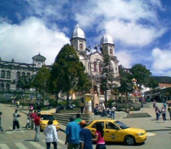
Rosenda Torres School and Minor Basilica of Our Lady of Mercy.
Basilica of Our Lady of Mercy.
Capilla del Carmen, better known as Capilla de San Luis, was for more than 80 years the parish temple of Yarumal while the basilica was being built.
Francisco Antonio Cano House of Culture.
Rosenda Torres School, a building designed by the Belgian architect Agustín Goovaerts.
Seminary of Foreign Missions, founded on July 3, 1927 by Monsignor Miguel Ángel Builes.
Christ the Priest Seminary.
Monsignor Juan N. Rueda Museum, which contains religious historical pieces.
Ecological destinations:
Puentepiedra, a natural bridge over the Nechí River, located about 12 kilometers from the urban area. It can be accessed from the Angostura road, a short distance from the Mallarino bridge. The river flows under a rock formation in such a way that it cannot be seen or heard, and reappears on the surface some 600 m later.
Arco de Velez Bridge. Those who enjoy ecological walks often head to this place where there is a ruined arch. It was an obligatory place for trade between the Atlantic Coast and the center of the country. It was built in 1887 and named Puente Vélez in honor of the lawyer and general from Envigado Marceliano Vélez Barreneche. The work was built by Baldomero Jaramillo Ruiz.
Chorros Blancos sidewalk. There is a country inn with a swimming pool, table tennis, billiards and a sports hall. You can hike up the hill, famous because there, on February 12, 1820, the last great battle of Independence was fought. Six months after the battle of Boyacá, a group of 100 royalist soldiers under the command of Colonel Francisco Warleta tried to regain control of New Granada and reach Peru, but that day, in Alto Boquerón, they were defeated by Lieutenant Colonel José María Córdova, who when he was barely 20 years old was already Governor of the province of Antioquia and was at the head of an important fraction of Simón Bolívar's army.
Comments
We don´t have yet any comments about:
Yarumal
Yarumal
Be the first to leave a comment as it is very important to inform other people
Outros locais a visitar
Within a radius of 20 km from:Yarumal
Unfortunately we do not have information on other places to visit in this area yet
Hotel reservation near Yarumal within a radius of 20 km
No results
Why to book with ROTAS TURISTICAS
The best prices
Our partnerships with the world´s largest operators offer research on the best market prices.
More options
At Rotas Turisticos you can book the hotel, buy the air ticket, book the transfer from the airport to the hotel and vice versa, book the local excursions, rent the car, take travel insurance and consult the places to visit and where to go.
Holiday Tips & Destinations
Hundreds of holiday destinations with all the options that allow you to easily choose the destination that best suits your dream vacation.
ROTAS TURISTICAS
Links
Follow us on social networks


