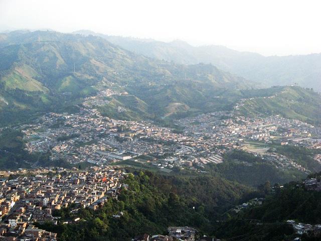
Villamaria


Villamaría, Caldas, Colombia
Suggest Place to Visit
1742
Track to location with GPS |
 |
Founded date: October 19, 1852
Name of the founder (s): Víctor Castaño, José María Ceballos, Alberto Salazar, Benedicto Ángel, Ezequiel Arango, Eufrasio Jaramillo, Pompilio Hurtado, Antonio Cardona Valencia, Miguel Toro, José María González, Domingo de Gregorio Gallego and Mario Ceballos
In line with the historical records presented so far, the previous presence of indigenous settlements in the current territory occupied by the Municipality of Villamaría is evident, given that guacas or anthropological finds have been found in the Veredas La Guayana, La Floresta (farm sector La Alquería) and Llanitos, and in the urban area during the adaptation of the land for the construction of the San Diego neighborhood located in the Turin sector, as well as the construction of the swimming pool of the Sports Center. On the disappearance of these first settlers, belonging to the Quimbaya and Carrapa families, the opinion that was produced by the frequent eruptions of the Nevado del Ruiz volcano, which the indigenous people called Cumanday (which means Beautiful White), and the cultural shock represented by the violent irruption of the Spanish conquerors in the Caldense region, which began in the year 1535. From then until the year 1834 when Don Fermín López and his relatives arrived to settle near the San Cancio hill, the territory was abandoned, serving as an occasional passage for adventurers between the provinces of Cauca and Antioquia.
Having entered that great socioeconomic process called La Colonization Antioqueña, we find that with the famous Expedition of the Twenty, which occurred in 1848, numerous families from Neira, Salamina, Aguadas, Pácora, Sonsón, Abejorral and Rionegro constituted a population that later they would call Manizales. Some new residents of this town, faced with the refusal of the González y Salazar company to cede or sell land to them so that they could satisfy their wishes to settle in Manizales, decided to cross the Chinchiná River, previously called Tacurrumbí in memory of the main chief Quimbaya, and began the foundation of a town in the La Capilla site where they built several straw huts.
The founders, among others, were: Víctor Castaño, José Maria Ceballos, Alberto Salazar, Benedicto Angel, Ezequiel Arango, Eufrasio Jaramillo, Pompilio Hurtado, Antonio Cardona Valencia, Miguel Toro, Jose Maria González, Domingo de Gregorio Gallego and Mario Ceballos. Due to the proximity to Manizales, the hunt initially depended on this population under the name of Partido de Chinchina, until mid-1951 when the neighbors agreed to give it the name of “Aldea de Maná” in view of the fertility of the lands. . Due to lack of water, residents were forced to move the population of the chapel sector to the right bank of Quebrada La Diana, where it began to grow dynamically.
At the end of the year 1851, the inhabitants of the Aldea de Maná, faced with the frequent incursions made by the representatives of the González and Salazar company, who had nothing to do in the population because this was another state, formed a board and through a document drafted by Mr. Ezequiel Arango, they asked the Cauca Provincial Chamber of the Sovereign State for the official pronouncement of the new hamlet in Aldea, with the name of Aldea de Maná. The request was promptly answered, but the handwritten name, misread, misspelled or misunderstood, was changed to the name of Maria, which continues to be her only official name. The Ordinance by means of which "Maná" was listed as "Aldea de María", was issued on October 19, 1852 in the city of Guadalajara de Buga, attached to the parochial district of Cartago. Once this legal recognition was obtained and the official visit was made, the residents continued to make openings in the middle of the jungle and plant crops appropriate for the region. Trade increased between the villages that emerged and it became necessary to adapt roads such as the old road to Manizales (1850), the Privilege road (1855) and the Arana road (1880).
Unfortunately these routes also served for war. On August 24, 1860, General Tomás Cipriano de Mosquera arrived at the Aldea de María with an army of 3,500 infantry and 500 cavalry men, 5 cannons, bands of music and abundant ammunition, ready to take Manizales converted at that time , in the last military bastion of the Sovereign State of Antioquia. General Mosquera went up to Alto del Roble to observe the enemy's disposition and on August 28 began the battle of Manizales, which could not be taken by the fierce defense and the Cauca army, demoralized and out of breath, had to reorganize the next day in the Village of Maria. Later, General Julián Trujillo, commanding the liberal forces of Cauca, was able to take Manizales, propping up his combative forces in the Aldea de Maria where he established his camp at the beginning of 1877
This period of civil strife delayed the development of the municipality and the atmosphere of anxiety worsened during the so-called Thousand Day War, which began on October 17, 1899 and ended on November 21, 1902, due to the conservative hegemony that was in power, he maintained strict control over the liberal guerrillas that roamed the upper area of the town, threatening to take over the village. Another limitation to population growth in this period was the appearance of smallpox in 1903, a terrible epidemic that twenty years ago had left 1,500 dead and hundreds scarred. With the creation of the department of Caldas on June 5, 1905, Villa de María, which had become a Municipality on July 26, 1878, became part of the new departmental cell. Towards this time of the beginning of the century, the town that had been organized in a concentric way according to the traditional patterns of the colonizers (orthogonal grid), inherited from the Spanish, changes by the longitudinal shape along the 5th wagon. By then, coffee cultivation had already begun in the region and the population was increasing, in large part due to the attack of the overhead cable area and the Caldas railway, which attracted numerous workers from Cundinamarca, Boyacá, Tolima and Cauca. The aerial cable was inaugurated in 1927 and its use time of only a few years was conceived as a way to accelerate the work of the Caldas railway and help in the reconstruction of Manizales after the terrifying fires of 1925 and 1926.
The first locomotive of the Caldas railroad arrived in Villamaría in September 1927. The railroad constituted a preponderant factor for the agricultural development of a large sector of our Municipality.
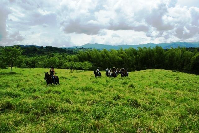
Villamaría, popularized name of the Municipality since the beginning of the 1860s and known from a century later as the Villa de las Flores because of the attractiveness of its landscape and the deep horticultural and floricultural tradition of its inhabitants, lies on the west flank of the Central Cordillera of the Andes, on meta-sedimentary rocks, cretaceous schists and fluvio-volcanic deposits that have been eroded and shaped by the action of surface water sources, abundant in its territory. It is located in the south-central part of the Department of Caldas. The municipal seat is located at 5º 3 ’north latitude and 75º 31’ longitude west of the Greenwich meridian. Its altitude is 1,920 meters above sea level and its average temperature is 18ºC. The approximate area is 461Km2 distributed as follows: 185 Km2 of moors, including perpetual snow; 230 Km2 of cold climate and 46 Km2 of medium climate. The city is linked to Manizales by a 4 km paved road and therefore to the entire country, with a road of acceptable specifications. All the sidewalks of the municipality are communicated by a large network of unpaved penetration roads.
GEOLOGY: The territory is made up of characteristic materials of igneous and metamorphic rocks, the result of a series of eruptions from the Nevado del Ruiz Volcano and long-term transformations on rocks. In a general direction from north to south, the geological layers are delimited and the slate and clay components are located almost vertically, which gives rise to sheets perforated in a parallel manner.
PHYSIOGRAPHY: The physical geography of the municipality is characterized by the contrast of the gentle slopes with the very strong ones, which originated depositional and erosive phenomena, which when combined with the tectonic, volcanic and anthropic processes formed the current relief.
POLITICAL ADMINISTRATIVE DIVISION: The territorial section is divided into urban area and rural area. The urban area made up of the Traditional Villamaría or Centro and a series of urbanizations around it.
The rural area is made up of 34 trails.
DEMOGRAPHY: According to the population projections prepared by DANE based on the 1993 census, the last one carried out, the total population of the municipality of Villamaría is approximately 50,000 inhabitants, of which 35,000 live in the municipal seat and 15,000 in the rural area.
Limits of the municipality:
MUNICIPAL LIMITS: To the north with the Municipality of Manizales, to the west with the municipalities of Chinchiná and Santa Rosa de Cabal (Risaralda), to the east with the municipalities of Herveo and Murillo in the department of Tolima and to the south with the municipality of Santa Cabal rose.
Total extension: 461 Km2
Economy
MINING: The economic activity of the first inhabitants of Villamaría focused on mining. Some of the mines continue to be exploited, counting more than 20 between gold and silver; The best known are: California, Gallinazo, Toldafría, La Gloria, La Telaraña, La Morisca, El Diamante, La Zorra, Pipintá, El Algarrobo, El Contento, Volcanes, Santa Ana, El Porvenir, Olivares and Termales, whose products are gold , silver, lead, zinc, iron, limestone, copper and antimony.
AGRICULTURE: The total area dedicated to agricultural production in the municipality is approximately 28,000 Ha., Coffee and timber being the crops that occupy the largest area with 2,300 Ha. And 2,500 Ha., Respectively; They are followed by potatoes with 900 Ha., cold-climate fruit trees 650 Ha., banana 400 Ha., legumes 180 Ha., and vegetables 160 Ha. Among the cold-climate fruit trees, apple and Feijoo stand out, of which it is estimated 150 Ha were planted. The largest farms are located mainly in the cold zone and are dedicated to livestock exploitation, potato crops being also frequent.
INDUSTRY: Villamaría is considered, after Manizales, the most industrialized municipality in the department, a factor in recent years has generated a significant number of jobs for its inhabitants and those of Manizales. The industrial zone is located on the Pan-American highway and has an easy access to the urban area of Manizales. In the urban sector of La Pradera there is an industrial nucleus in which important companies of the region are based.
Villamaría is a municipality located in the south of the department of Caldas, on fertile lands and a natural beauty that make it call the Garden of Colombia.
Comments
We don´t have yet any comments about:
Villamaria
Villamaria
Be the first to leave a comment as it is very important to inform other people
Outros locais a visitar
Within a radius of 20 km from:Villamaria
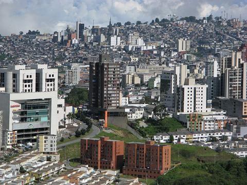
Manizales |
| 6,8 Km |
 |
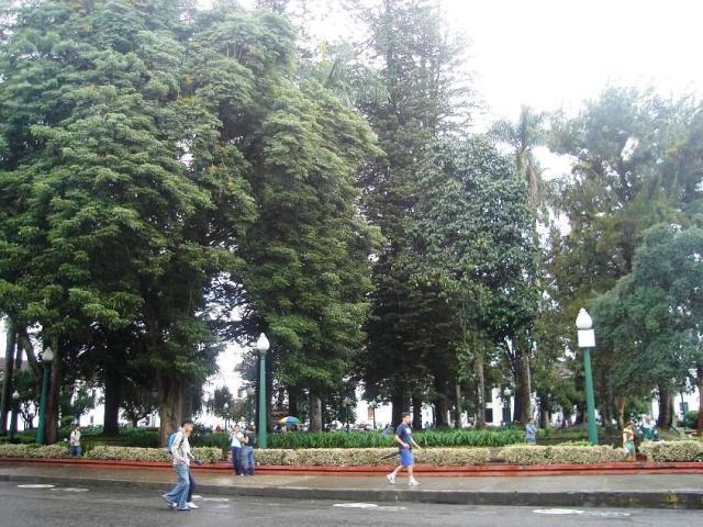
Caldas Park |
| 7,7 Km |
 |
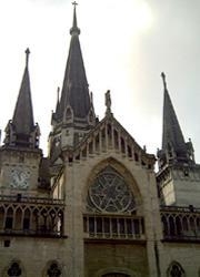
Cathedral Basilica of Manizales |
| 9,2 Km |
 |
Santagueda |
| 14,3 Km |
 |
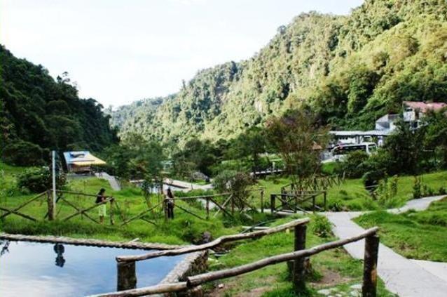
San Vicente hot springs |
| 19,0 Km |
 |
Hotel reservation near Villamaria within a radius of 20 km

Why to book with ROTAS TURISTICAS
The best prices
Our partnerships with the world´s largest operators offer research on the best market prices.
More options
At Rotas Turisticos you can book the hotel, buy the air ticket, book the transfer from the airport to the hotel and vice versa, book the local excursions, rent the car, take travel insurance and consult the places to visit and where to go.
Holiday Tips & Destinations
Hundreds of holiday destinations with all the options that allow you to easily choose the destination that best suits your dream vacation.
ROTAS TURISTICAS
Links
Follow us on social networks


